"The" Joshua Tree

The friendliest place on the web for anyone that follows U2.
If you have answers, please help by responding to the unanswered posts.

Zooropa man

Refugee
Joined
Aug 20, 2002
Messages
1,252
Location
Los Angeles, CA
Just wanted to know if anyone here knew or has a link to a satellite map showing the exact location of the Joshua Tree in CA. I know that there was a map floating around the net a while back. If I recall it was a google map. Thanks!
 
It's from an area outside of Death Valley National Park I believe (it's not Joshua Tree National Park despite popular belief). That album cover photo is from Death Valley. I actually went through that area back in November
 
So the actual "tree" was in Death Valley?
hmmm...

Well, if anyone has the coordinates for it, I would appreciate it. I might just make it a trip. :eyebrow:
 
I used to have them, but I don't know where they went. I really wanted to go see it but the trip was too long just for that. I should try and find them again one day.
 
Yea that picture in catlhere's signature is from a place in Death Valley called Zabrinske Point. I have a picture from pretty much that exact spot...Funny thing is I didnt know this was the spot at the time I took it
 
Yeah, I know that one is from Zabrinske Point. I know that there has to be someone out there that knows where the tree use to be... or the remains of it is.
 
I had the exact cooridinates but it was in my other computer that unfortunately got formatted.

found it...Here it is at Google Maps -

http://maps.google.com/maps?q=http://bbs.keyhole.com/ubb/download.php?Number=772968&t=k&om=1

And the link for Google Earth -

http://bbs.keyhole.com/ubb/showthreaded.php/Cat/0/Number/772968/page/

A site with some great photos and exact location shots.

http://www.ashborofaith.com/u2jtsearch.html


If you're looking for the location on the actual album cover then that was taken at Zabriskie Point in Death Valley.
You can go into Google Earth to the exact camera angle of the photo. It's pretty cool.

Google Maps - http://maps.google.com/maps/ms?ie=U...d=101963118169256393652.00000112781a7e956eb28


zabriskie.jpg


Or perhaps you would like to check out the Harmony Hotel in Twentynine Palms.

http://www.harmonymotel.com/about.htm

Google Maps - http://maps.google.com/maps/ms?ie=U....137437,-116.110125&spn=0.008383,0.01442&z=16

4zy1og5.jpg
 
Last edited:
Ya the tree is not in Joshua Tree National Park. The Google Earth link was from somebody else so I do not know 100% sure if it is the exact coordinates. But, from research I did on the location, which I lost, it does seem to be pretty spot on within 100 metres. It's definitely in that general area south of the 190. You can compare in Google Earth with the photos of that other link I posted of that person's trip there.
 
Last edited:
I think I finally found what I'm looking for....

I used google earth to check out the terrain to angle it and... whala!!! same mountain range that it shows in the backdrop of the tree. Nice work guys!
 
Zooropa man said:
So Martha... you where actually there?
Cool... it must be right off the highway like all signs indicate right?

It's about a mile or so off the highway. You have to wander through the sand for a ways.

Now that it's fallen, it's harder to spot. When it was standing, you could see it from the highway. I've been there three or four times. We vacation in that area every Thanksgiving.
 
martha said:


It's about a mile or so off the highway. You have to wander through the sand for a ways.

Now that it's fallen, it's harder to spot. When it was standing, you could see it from the highway. I've been there three or four times. We vacation in that area every Thanksgiving.

Nice! Thanks for your help. I'm gonna try and find it sometime this summer.
 
Even if you don't find "THE" tree, it's just an awesome experience driving in that area. It's magical, a spiritual sojourn for any true U2 fan, especially those whose favorite U2 era is JT. Definitely listen to JT while driving around there! :up:
 
I'm heading to LA in autumn, is there any other U2 sites to see in LA besides the "Streets" vid location?

Martha - your gallery is vuurry cool!
 
Hi all:

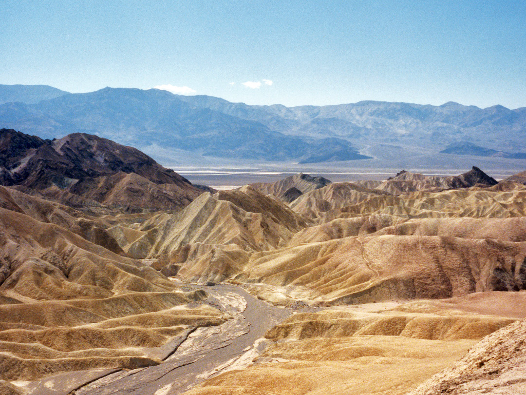
Just jumped in rather late. I was down at the Joshua Tree on May 19, 2007. The area is looking good (fans keep it clean and undisturbed). I was at Zabriski Point as well. Death Valley Junction is where many photos were also taken of course. Bodie is at the start of their desert journey. The end of the journey is at 29 Palms, where the Harmony Motel is located. The JT tour book has the photos of course. I have found most of the sites where the photos were taken. The "two telephone poles", these shots of the band can be found on HWY 190, mile marker 130. north side of the road. Not too far from Death Valley Junction. In Shoshone, south of Death Valley Junction, you can eat the Crowbar Cafe, where Bono once ate.

I have a few more desert trip sites to find, but most of them I have found now; I have GPS coordinates of those found as well. It worries me giving out the info out though; I hope no one damages the sites.

Just for fun, over the past couple of years I have been tracking U2's original desert trip, and I have the route down. It's Hwy 395 from Bodie, south to hwy 190, beginning to end at Death Valley Junction. South from there on 127 down to I15 onto Kelbeker Rd. cross I40 and continue on Kelbeker Rd. Turn west on Old National Hwy (Route 66), for a couple of miles, then south again on Amboy to 29 Palms.

There is their Desert Trip. It's fantastic and it helped make the Joshua Tree. You'll feel the songs as you drive it.
 
I found the tree on December 31st, 2006! It took about 1 1/2 hours of searching on foot through the desert. My husband and I split up and he spotted it just before the sun started to set. The coordinates and directions that I found off the internet were off by just under 2 miles, but with the album cover in hand we managed to line it up and then just head out into the desert. It is definitely a ways out there. What an amazing site though. What the fans have done is really awesome. And by the looks of it, not many fans have made it out there. I feel very lucky to have found it.
 
Zooropa man said:
I think I finally found what I'm looking for....

I used google earth to check out the terrain to angle it and... whala!!! same mountain range that it shows in the backdrop of the tree. Nice work guys!

What's a "whala"? Oh, you mean voilà (or voila). :sexywink:

For years, people who did come across the tree refused to divulge where it was. U2 even felt this way. This was because it was feared that something would happen to the tree. Sadly, both the tree on One Tree Hill and "the" Joshua Tree are no more. So now people are revealing the location of where "the" Joshua Tree was (sans tree, of course). At least we have pictures and the album to remember them. :yes:
 
doctorwho said:


What's a "whala"? Oh, you mean voilà (or voila). :sexywink:

For years, people who did come across the tree refused to divulge where it was. U2 even felt this way. This was because it was feared that something would happen...

Yeah, I guess that's what I mean. lol

I guess I just want to make that trip. I think that it'll be awesome to just stand there and breath in the desert air that sorrounds the landscape.

For the ones that have been there recently, would you guys mind giving me the exact location of it? How far off the road it is, what marker etc. etc.... any information you may have. That way it won't take long hours of searching... I would gladly appreciate it. I know some are very ademant about sharing the coordinates and such but... c'mon, we are U2 fans right?

mr_mcphisto93@yahoo.com

Thanks!
 
Back
Top Bottom